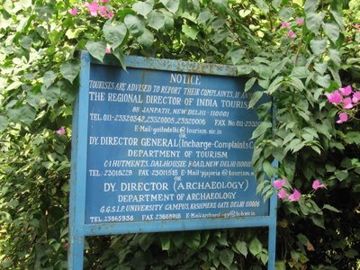
As I proceed towards the entrance of Qudsia Garden, near ISBT, a place of historical significance, I stumble upon an information tablet put by INTACH and the Delhi Administration...all these years, I had never known its existence...these are the joys of taking a walk...
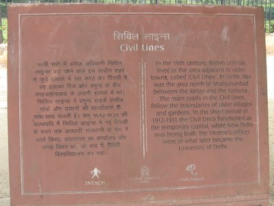 The stone tablet (pic above) states that for a period of around 20 years, from 1911, when the National capital was shifted from Calcutta to Delhi, till the time Lutyen and his bandwagon could complete the construction of New Delhi, Civil Lines operated as the capital of India. All British officials were housed here ...many buildings, believe me are still there, intact or in ruins. Will definitely try and upload some snaps...later. For the time being, let's proceed with the story of the seige of Delhi...year being 1857.
The story and ofcourse this article can be understood only with the help of this map. Use it as a reference throughout...
Advise: Do a right click on the map and open it in a new tab/window...this way the map would be larger.

The Key to reading the above map:
Color Coding:
- The green area is the Northern Ridge (now known as the Kamala Nehru Ridge), the greenest portion of Aravali’s left in the city.
- Blue area is the River Yamuna
- Yellow area is the Red Fort (Lal Quila)
- The red outline is roughly the area of what was known as Shahjehanabad, the Seventh city or the ‘Walled City’. It was ‘Dilli’, the city during the mid-later 19th century. Later, it seems, even the outskirts were included and the entire area was branded as Old Delhi, just to contrast it with Lutyen’s Delhi, which was being built down South. Note how the Red Fort comes within the folds of Old Delhi and how it touches the banks of River Yamuna. Before the river was forced to recede, it must have been much closer to the fort.
- The black squarish dots are various places of historical importance.
- The colored and numbered dots (11 in all) are the important places associated with the 1857 mutiny.
Number/Name of the place
1. Kashmere Gate
2. Nigambodh Gate
3. Delhi Gate
4. Turkman Gate
5. Ajmeri Gate
These are/were, it seems, the 5 existing gates of the city being defended by the mutineers (during 1857), who had barricaded themselves within the city walls. In all, there were 10 gates into Shahjehanabad . The British attack came primarily from Ludlow Castle (10) and Qudsia Bagh (11), just outside the city walls and very near to Kashmere Gate (1), which was finally breached by the British.
6. Red Fort
7. Delhi University/Viceregal Lodge
8. Flagstaff Tower
9. Chowburzi Masjid (pics later)
10. Ludlow Castle
11. Qudsia Bagh
Now to proceed with the story…it is believed that baffled by the fall of Delhi into rebel hands, Lord Canning, the then Governor General, stationed at Calcutta took some severe measures. One was to deploy army units at all possible places on the outskirts of Dilli. This was somewhere in May 1857. The Baadli area was under the occupation of the rebel sepoys …the British unit coming from the north of Baadli confronted the rebels and pursued them till the northern ridge (yellow area on the map). Thereafter, the ridge became an important territory for the British because of it’s strategic location. Delhi (Dilli) lies (lay) on the west bank of the river Yamuna. There were ten gates leading into the city out of which three were near the ridge. The ridge thus afforded an ideal defensive position for the British. Also the northern half of the ridge was outside the range of the guns mounted on the walls of Dilli. The area to the ridge's west was protected by the Najafgarh Drain which was a complete water obstacle.
While in the ridge they constructed a number of structures…the Flagstaff Tower (pics below) and two guard gates (at least that is what they seem to be) on the north and south of the Flagstaff Tower. The records say that unable to take the Baadli defeat, the rebel sepoys launched a number of attacks and counter attacks on the British army units stationed on the ridge, but every attempt was thwarted primarily because the sepoys inside Dilli were a highly disorganised and unruly mob. They had no unified leadership. Bahadur Shah Zafar, their forced titular head was just an ailing 85 year old who had no intention or inclination to lead the sepoys…infact history says that given a choice, he would have sided with the British who were giving him some pension atleast!
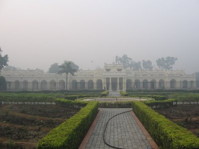
Old Viceregal Lodge (see map for location), presently the office of the Vice Chancellor of the Delhi University…early morning fog beginning to lift.
During the British times, the moment Viceroy used to move out of the place, a bugle sounded at the Flagstaff Tower (see map)…’Laat Saheb’, as he was popularly called, used to then proceed towards the civil lines area on an official routine inspection. Civil Lines, as already mentioned, served as the makeshift capital of Delhi till the time Lutyen was ready with his version, that is, from 1912-1931.

The Flagstaff Tower …now all renovated by the Archaeological Survey of India. The Union Jack used to add colour to the flag pole that is still there (see picture closely). I suggest that we should have the Indian Tricolour now…any penny for my thoughts?! ; )

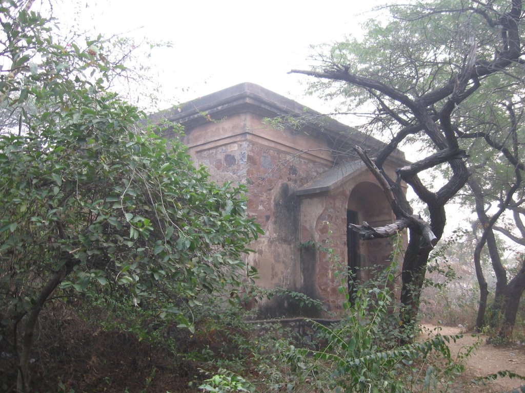
As mentioned in the earlier narrative, when the British occupied this place during the revolt of 1857, due to its strategic location, they constructed many structures. One of such structures you can see in the picture is the Guard House…there are two such buildings in the Northern Ridge—on the north and south of the Flagstaff Tower. The Guard Houses were obviously to keep an eye on the Sepoy activity below and to forewarn the British army of any danger. During the revolt, the British women and children gathered on the ridge to have a safe passage to Karnal through the greens (see map).
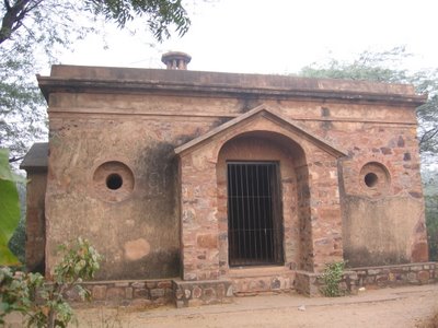
Northern Guard House (same as above) from a different angle...

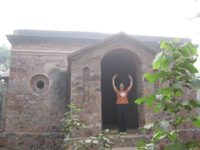
Southern Guard House...different vantage points
After the Northern Ridge, slowly, the sepoys also lost Ludlow Castle, which they had earlier occupied, to the British. Ludlow Castle then became an additional post for the Brtish army. In quick succession, they occupied the neighboring Qudsia Gardens as well. Ludlow Castle and Qudsia Gardens were two very strategic positions as they were/are very near to the Kashmiri gate of Dilli (see map).
Now for some pictures of the Qudsia Bagh... 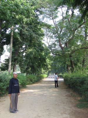
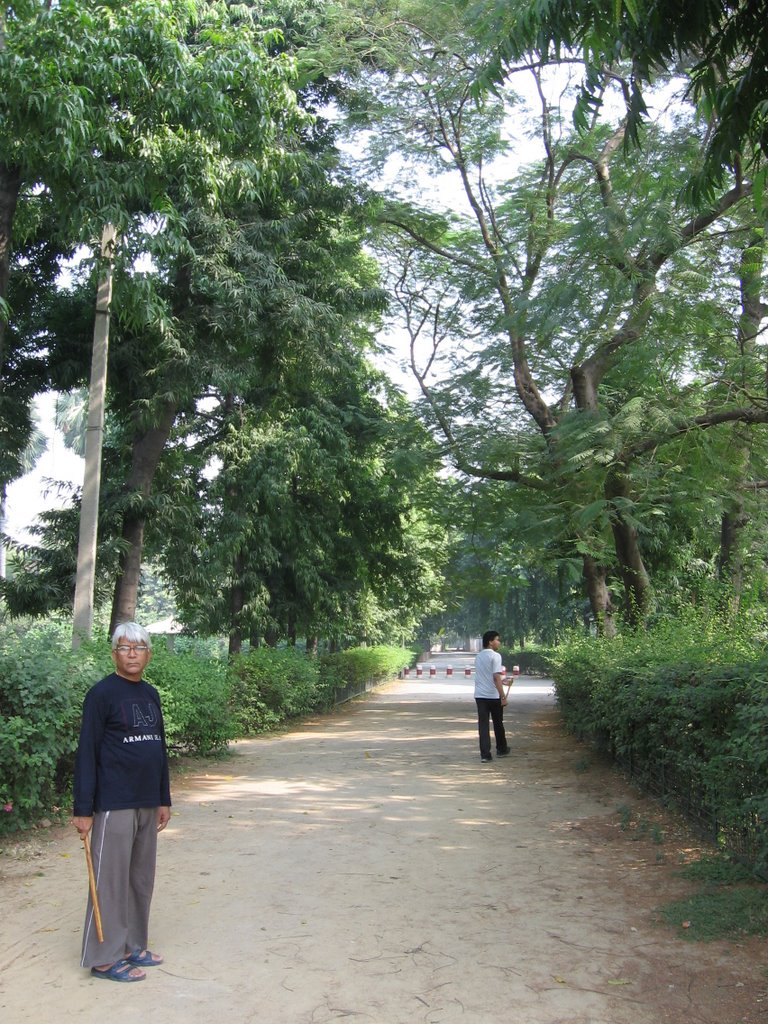
Entrance to Qudsia Gardens (see location on the map)…the place is as green as it must have been in the 1700’s and very tranquil. It is said that Qudsia Begum, the patroness of these gardens and after whom the garden has been named, was born Udham Bai, and was an 18th century dancing girl.
Huge trees still surround the pathways. The place was built by one Begum Qudsia, the Mistress of Mughal Emperor Muhammad Shah ‘Rangeelay’, one of the later Mughals who ascended to the throne of Delhi when the Mughal rule was in its twilight phase. He died in 1748.
Qudsia Bagh as it is known as, was originally near the river Yamuna, and was more a camping ground than a formal garden. The Emperor, it is believed, came here on extended picnics that included jackal-hunting.
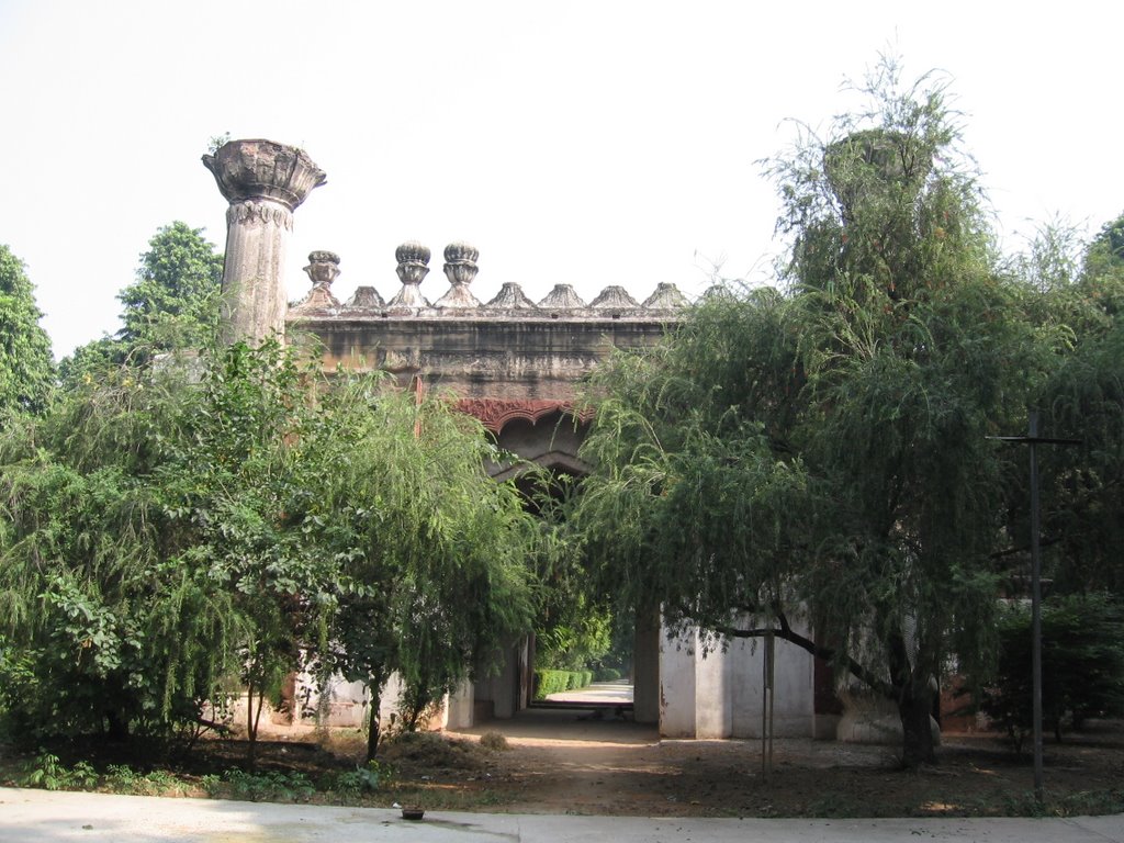
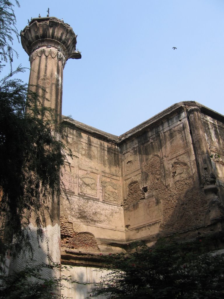
The mutiny of 1857 marred the beauty of the place. The Indian rebels barricaded themselves inside the Walled City (Dilli) to which the nearby Kashmere Gate was an entrance; the British, therefore, occupied Qudsia Bagh and made it their battery. In the subsequent shelling, hundreds died and Qudsia Bagh, not surprisingly, was more or less ruined (see map to get a better idea). Today, only three monuments remain in Qudsia Bagh: the entrance gate (as seen in the picture above... a very simple structure of cement and lakhauri bricks), the mosque, and the Baradari.


Entrance Gate from different vantage points...the structure clearly requires maintenance…plaster coming off at various places.
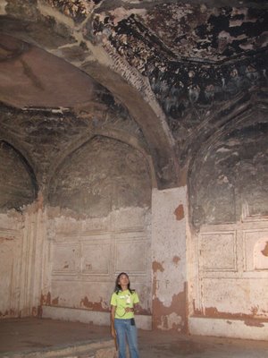
The inside walls of the gate…

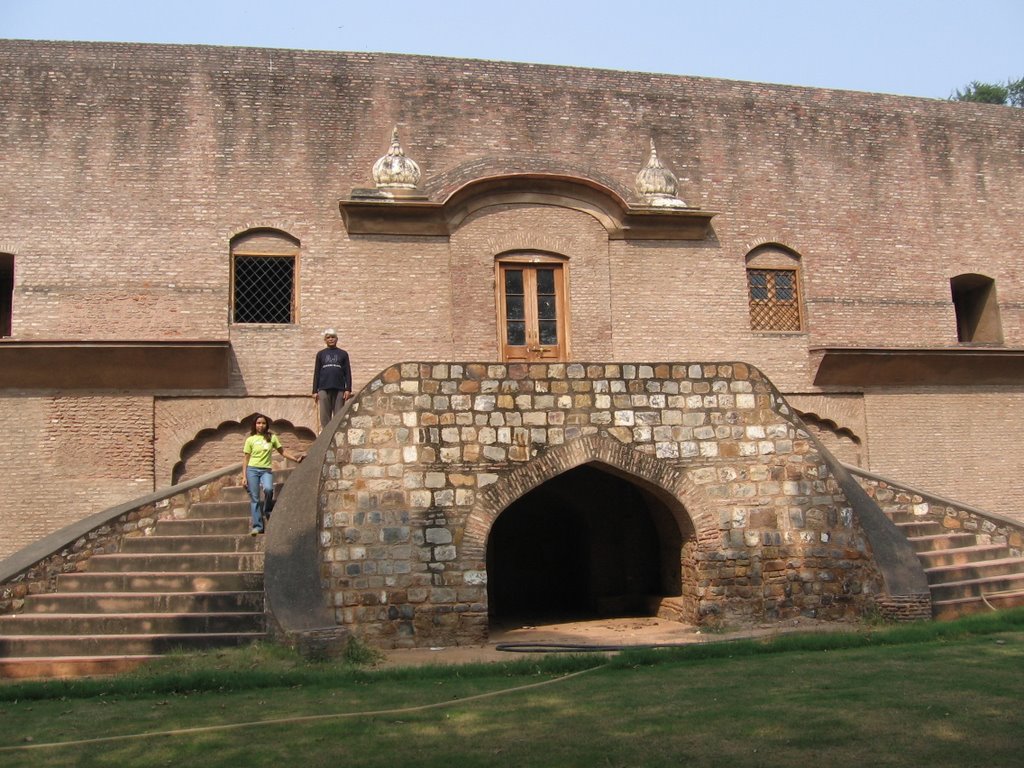
This was the Baaradari once (an open airy pavilion—an archeological structure typical of the Mughal architecture…) caused to be built by Begum Qudsia. Later when the British occupied the gardens during the revolt, many functional changes were made to the original building. Consequently, the building, as it is now, appears to be a very amusing blend of the two styles. This side of the building is typically British.
It is even rented out as cottages it seems...
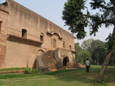

As you may see, the lakhuri brick part of the structure is old Baaradari and the remaining additions…stairs etc were added by the British.

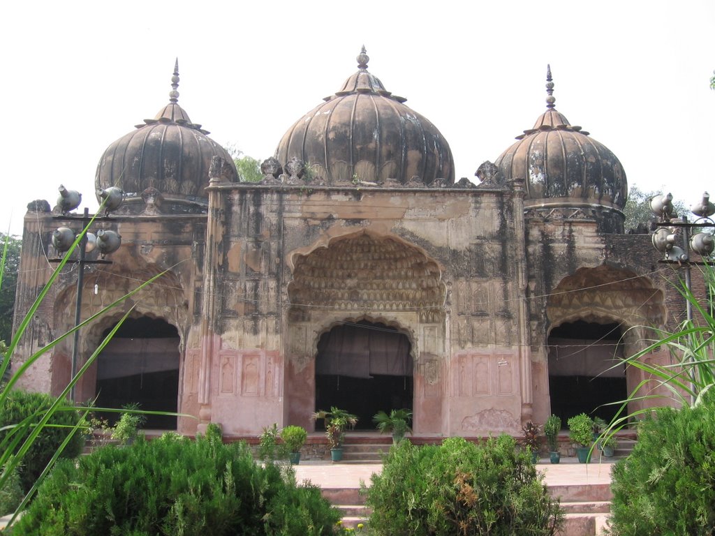
The place has a Mosque as well…built again by Qudsia Begum.
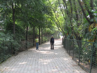
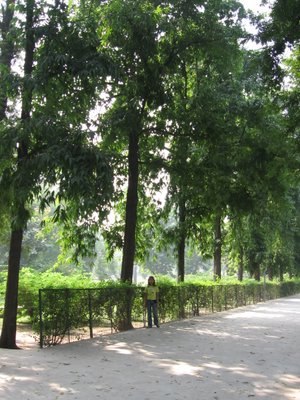
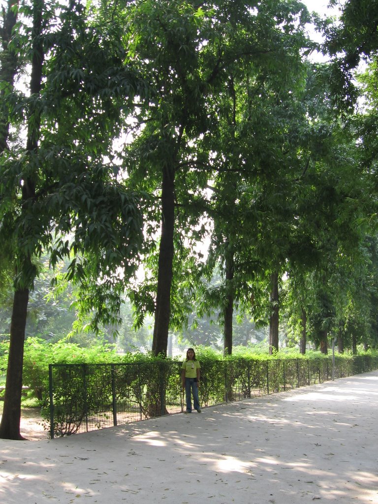
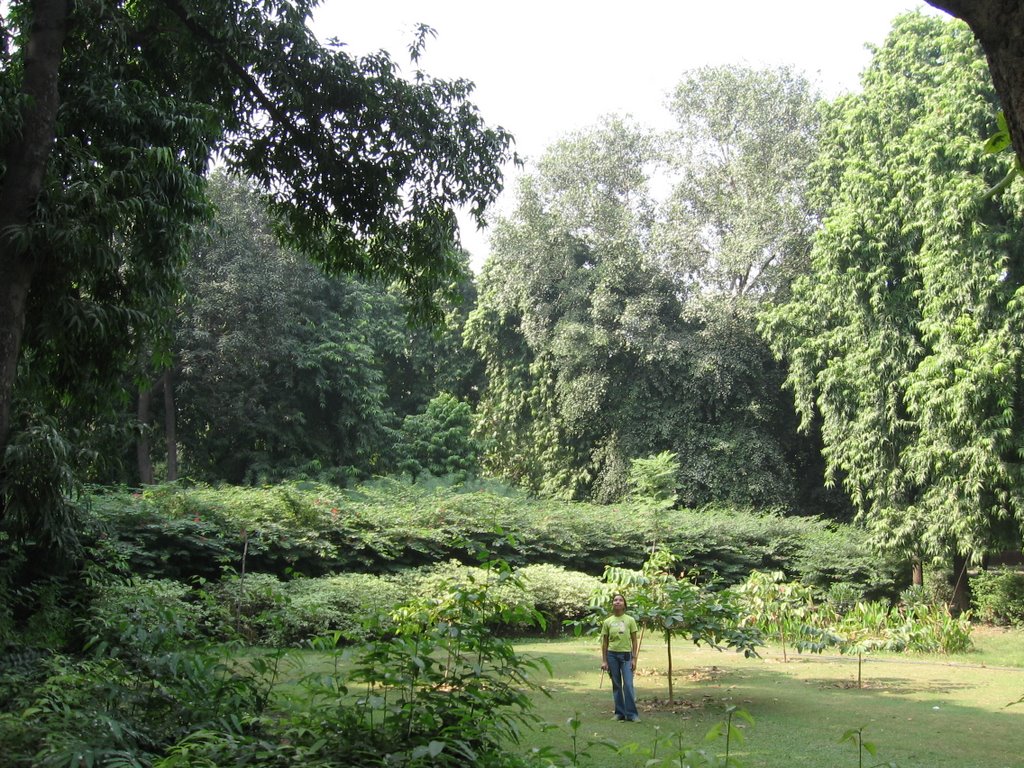
 Lush greens…singing/twittering of birds…total serenity take you to another world.
A brief mention of the Ludlow Castle, which was opposite the Qudsia Gardens. Now, the castle is no longer there…a government school by the same name runs on the very spot. Below is an archival photograph of Ludlow Castle, outside the walls of Delhi, India, taken by Felice Beato in 1858 during the Indian Mutiny. In September 1857, the British forces stormed Delhi from the area of Qudsia Gardens as well as Ludlow Castle, launching an attack on the nearby Kashmere Gate (see map for a better understanding).

Ludlow castle was a British residence built by a Dr Ludlow. Felice (Felix) Beato, a Venetian by birth, initially worked as a photographer in England. He can easily be branded as the official photographer of the Indian Mutiny (1857-1858).
The picture has been taken from the following website: http://www.defencejournal.com/2000/jan/dehli-campaign.htm.
Now that the reader knows what all places were occupied by the British to breach the walls of Dilli, the Kashmere gate in specific, it's time for the remaining story...
In the first week of September, records say that the last Mughal issued a proclamation that he would personally lead an assault on the British position at the ridge. On 12 September, in response to this call, some 10,000 soldiers and civilians gathered near the Kashmere Gate and awaited their leader (Bahadur Shah Zafar)…who never came!
Anyways, prior to that in August itself John Nicholson, about whom I have already written in the earlier post, had been commissioned to Delhi…Contrary to the Indian position, Nicholson led an able and organized attack against the Sepoys via the Kashmere Gate, which was finally breached after a bloody battle. The Sepoy camp was not only disorganized and infested with stoolies; it had almost run out of gunpowder/ammunition and food and hence was in dire straits.
Nicholson died in the encounter but British had gained entrance into the city…they marched till the Red Fort, hunted for the Emperor (and found him hiding in the Humayun’s tomb), and his sons ...imprisoned the former in Rangoon (Burma) and murdered the latter in cold blood. The route that Bahadur Shah Zafar took while fleeing is presently known the same name…yes: the Bahadur Shah Zafar Marg. The bodies of his unfortunate sons were dumped just outside the ‘Kotwaali’ near the Delhi Gate , as bringing the mutilated remains into the city had the risk of sparking off another rebellion (BTW, the Darya Ganj Police Thaana, just opposite the Delhi Gate is exactly the place where the Kotwaali existed during 1857. Yes, that is precisely why the station is still known as Puraani Kotwaali, Darya Ganj!)
 The stone tablet (pic above) states that for a period of around 20 years, from 1911, when the National capital was shifted from Calcutta to Delhi, till the time Lutyen and his bandwagon could complete the construction of New Delhi, Civil Lines operated as the capital of India. All British officials were housed here ...many buildings, believe me are still there, intact or in ruins. Will definitely try and upload some snaps...later. For the time being, let's proceed with the story of the seige of Delhi...year being 1857.
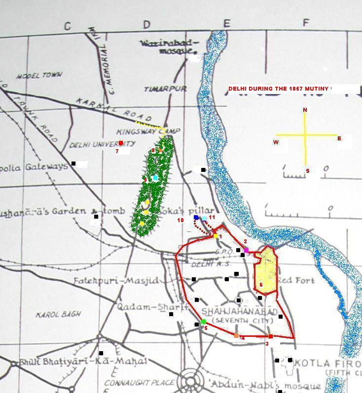


 Entrance Gate from different vantage points...the structure clearly requires maintenance…plaster coming off at various places.
 The inside walls of the gate…
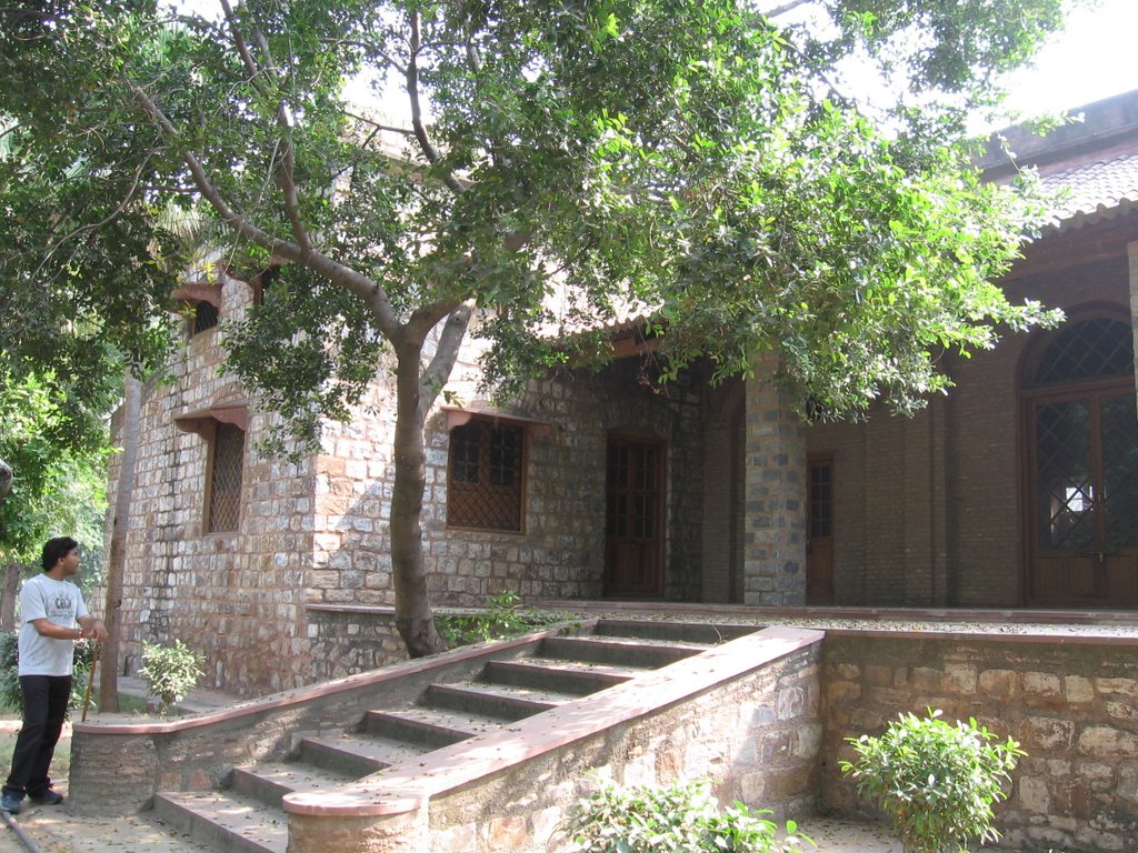
 It is even rented out as cottages it seems...
 The place has a Mosque as well…built again by Qudsia Begum.
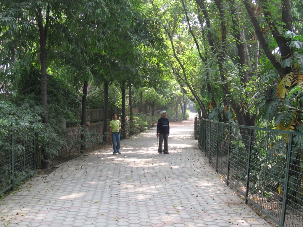
 Lush greens…singing/twittering of birds…total serenity take you to another world.
No comments:
Post a Comment